Lakes and Ponds
Lake Management
Lake Monitoring and Management
Welcome to our comprehensive suite of lake monitoring products!
Our software platform is a powerful tool for keeping track of and reporting on lake monitoring data. With this platform, you can centralise your data and access it at any time, generating reports and analysing trends over time.
Additionally, our lake monitoring buoys are equipped with advanced sensors to monitor important water quality indicators, such as dissolved oxygen, temperature, and chlorophyll-a. These buoys are easy to install and maintain, and they are designed to provide accurate, reliable data for lake managers and researchers alike. Whether you’re a scientist, a lake manager, or simply someone who cares about the health of our aquatic ecosystems, our products can help you make informed decisions and promote healthier, more sustainable lakes.
Read on below to find out more.

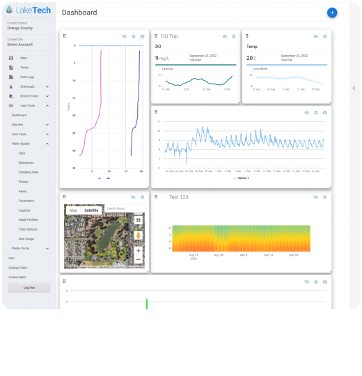
Lake Management Software
Lake Management Software
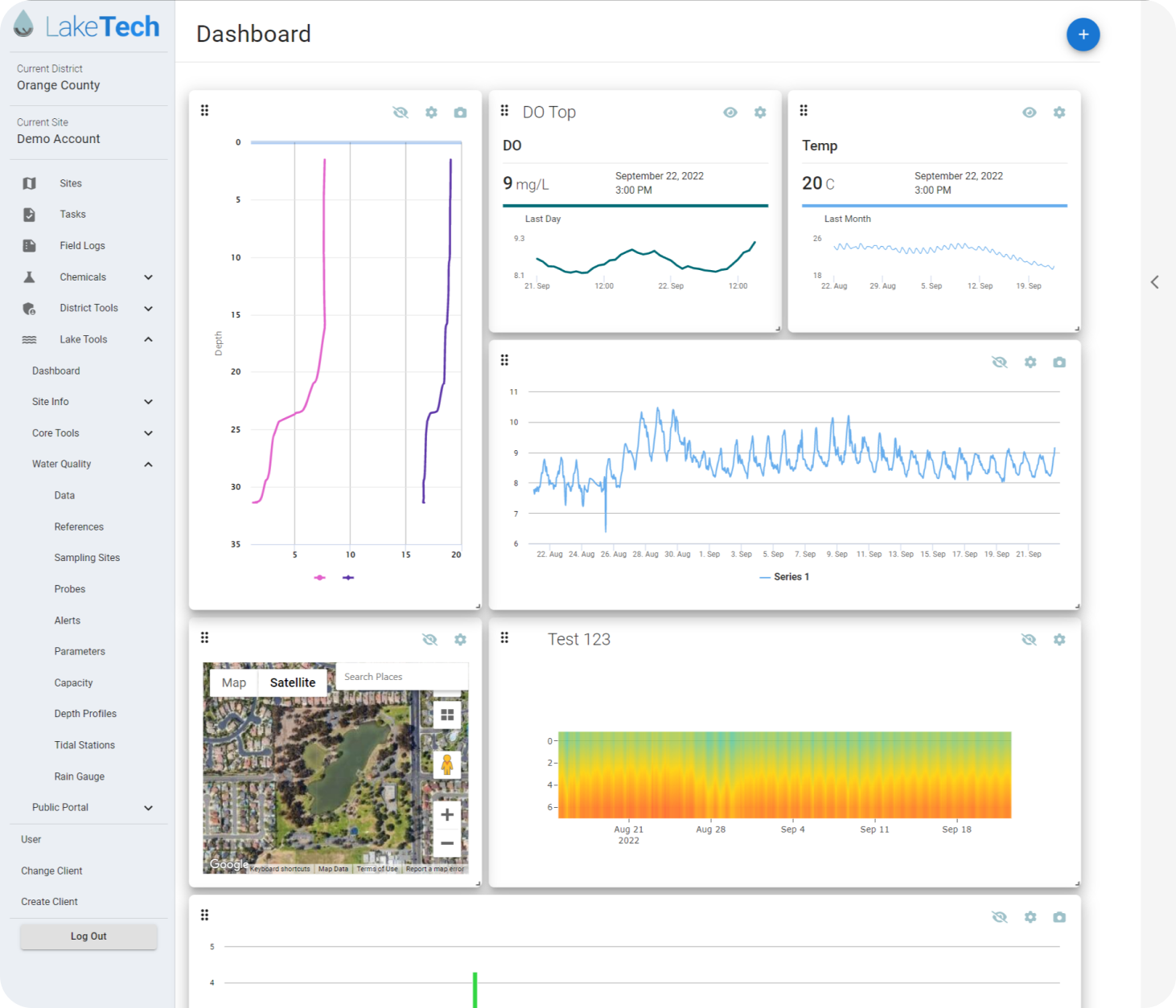
The LakeTech platform is designed to streamline monitoring and keep track of operations, management tactics, and to simplify evaluation and reporting for lake managers. The software provides an intuitive interface for users to input data about their lakes which is then organized into clear reports. The reports can be easily customized to show different time periods, water quality indicators, or management actions. The platform also includes a mapping tool that allows users to see their data in relation to other lakes in the area. This can be helpful for identifying trends or determining where management efforts might be most effective. Overall, the LakeTech platform is an invaluable resource for any lake manager who wants to improve their efficacy and efficiency.
LakeTech features real time probe data from monitoring buoys, real-time weather data, Isopleths and more across multiple sites.
Contact us today to for access to a free demo and to find out more information.
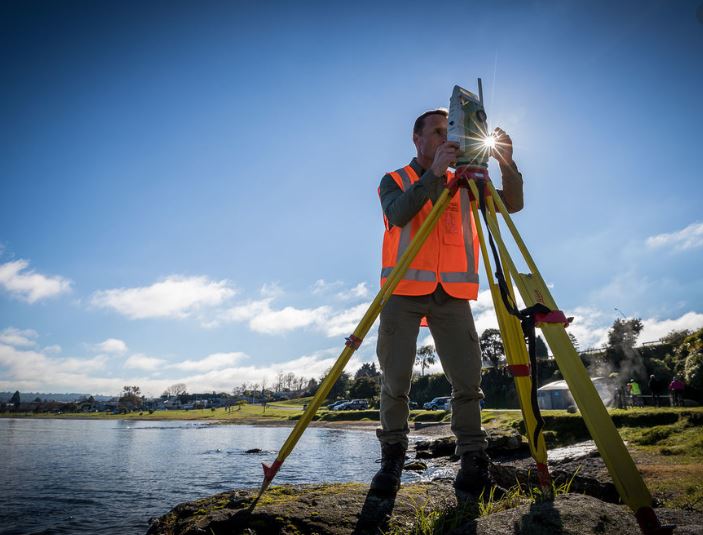
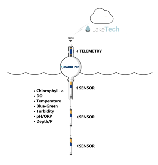
Lake Monitoring Bouys
Lake Monitoring Bouys
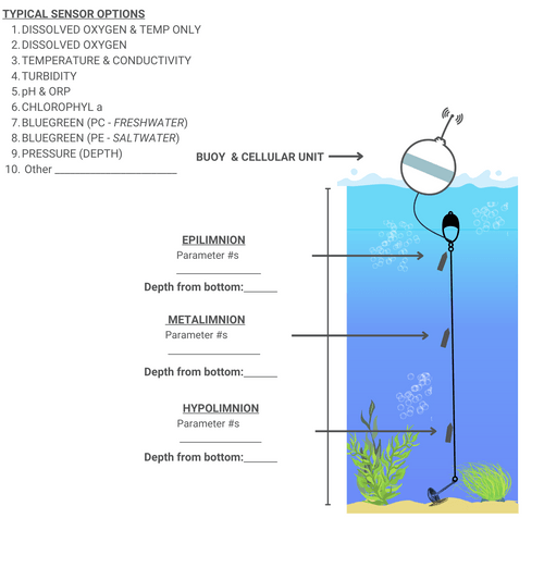
Our monitoring bouys are an affordable solution for people wanting to reliably and accurately record parameters including DO, T, Chlorophyl-a, pH, ORP, depth, turbidity or bluegreen algae.
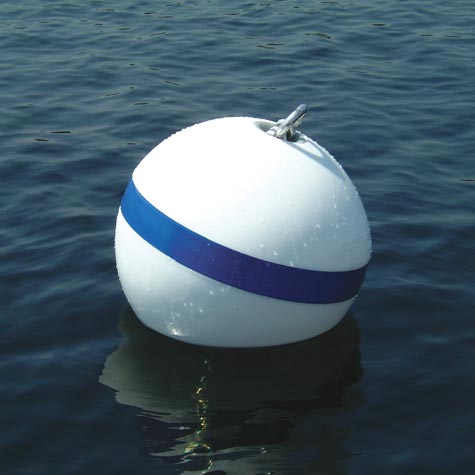
The sensors are connected to our buoys at varying depths, and the buoys inbuilt telemetry unit sends data real-time to the cloud which seamlessly integrates with the LakeTech platform. From small ponds and dams, to New Zealand’s biggest lakes, we have a solution that will work for all.
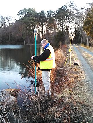
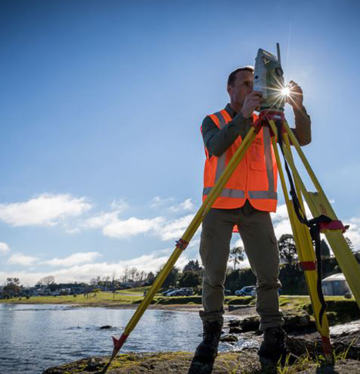
Sediment Surveying and Analysis
Sediment Surveying and Analysis
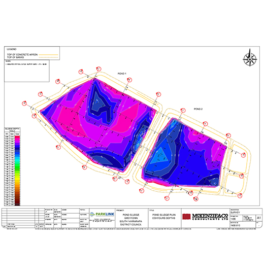
SEDIMENT AND SLUDGE ANALYSIS
Sediment patterning is a useful analysis process for determining quantities of accumulated settled solids (sludge) and the chemical and biological composition of the material.
We have the experience, equipment and expertise to carry out comprehensive sediment/sludge sampling in virtually any situation. Sediment analysis can be done in any pond or lake. Parklink uses mapping software for calculating sludge volumes. Samples can be collected at any depth without any interference or contamination to the test site.
We work to strict industry processes and procedures when collecting samples for scientific analysis and where necessary, testing is carried out by approved IANZ accredited laboratories.
Graphing and Reporting
Graphing and Reporting
GRAPHING AND REPORTING
Accurate and meaningful graphing and reporting is essential to understanding sediment patterning. At Parklink we use topographical modelling software and Excel-based calculating software to calculate volumes of sludge and dry mass.
Sludge samples can be collected at any depth without any interference or contamination to the test site.